
Skip to content
Photometric Mérnöki szolgáltató kft.
  • About us
  • Technologies
  • Services
    • Surveying & geodesy
    • 3D scanning
    • Building survey
    • Photogrammetry
    • Geoinformatics & facility management
    • Aerial photography & panoramic imaging
    • Virtual tour
    • 3D modelling & CAD processing
  • Products
    • Contour site plan
    • Orthogonal streetscape
    • Orthophoto
    • Aerial photograph
    • Section drawing
    • Elevation drawing
    • Floor plan
    • 3D virtual tour
    • 3D point cloud
    • 3D building model
    • Change survey plan
    • CAFM – Computer‑Aided Facility Management system
  • Projects
  • Prices
  • Blog
  • Contact
  • wpml-ls-flag
  • wpml-ls-flag
Request quote
Photometric Mérnöki szolgáltató kft.
  • wpml-ls-flag
  • wpml-ls-flag
Request a quote
  • About us
  • Technologies
  • Services
    • Surveying & geodesy
    • 3D scanning
    • Building survey
    • Photogrammetry
    • Geoinformatics & facility management
    • Aerial photography & panoramic imaging
    • Virtual tour
    • 3D modelling & CAD processing
  • Products
    • Contour site plan
    • Orthogonal streetscape
    • Orthophoto
    • Aerial photograph
    • Section drawing
    • Elevation drawing
    • Floor plan
    • 3D virtual tour
    • 3D point cloud
    • 3D building model
    • Change survey plan
    • CAFM – Computer‑Aided Facility Management system
  • Projects
  • Prices
  • Blog
  • Contact
  • Survey of the industrial park – Budapest, District XII
    Geodetic surveying | Uncategorized

    Survey of the industrial park – Budapest, District XII

    ByRomix-drop 2026.09.04.2026.09.15.

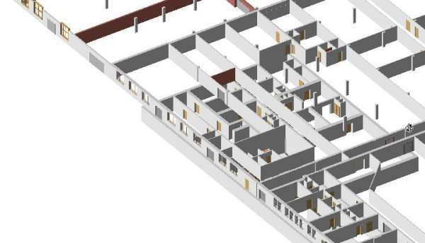
    The industrial area is located in Budapest’s District XI, covering more than 8 hectares bordered by Budafoki Road, Hengermalom Road, Szerémi Road and Galambóc Street. The total floor area of the warehouses, offices, halls and the underground cellar system within the industrial park is approximately 100,000 m². During the planimetric survey of the industrial site,…

    Read More Survey of the industrial park – Budapest, District XIIContinue

Facebook Facebook
GEODESY

Design map
Contour site plan
Change survey plan
Terrain model

BUILDING SURVAY

3D scan
Family houses
Heritage buildings

FOTOGRAMMETRY

Drone survey
Façade orthophoto
3D virtual tour

GEOINFORMATICS

CAFM systems
cemetery registry
Tree cadastre

The website was created within the framework of the Demján Sándor Program and with its support.

Created by Auri Consulting Tanácsadó Kft., WHATTHEBRAND Studio Kft. and PROMERA Menedzsment Kft.

Impress

Privacy Policy