


Orthogonal Streetscape
An orthogonal streetscape is a technical representation that displays street‑front façades in a flat, front‑facing, distortion‑free and uniform‑scale view. It is primarily used in urban planning, architectural design and heritage conservation, where accurate streetscape evaluation and documentation are required.
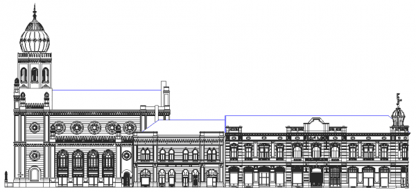
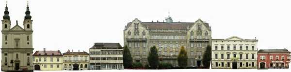
What is an orthogonal streetscape used for?
It can form part of the visual documentation required for building permit applications.
For assessing streetscape and urban visual integration.
For assessing the architectural and heritage value of protected environments.
For analysing the visual impact of new developments.
As an annex to Municipal Image and Character Manuals (TAK).
Who benefits from orthogonal streetscape documentation?
- For architects and designers
- For municipalities and chief architects’ offices
- For heritage conservation specialists
- For developers integrating a new building into an existing streetscape
How is an orthogonal streetscape produced?
Photogrammetric workflows typically involve capturing images with a drone or with specialised elevated‑camera technology operated from ground level at a height of 10–15 metres. This ensures that parked cars do not obstruct the façades in the final orthophoto.
The resulting streetscape can be delivered either as 2D vector drawings or as raster‑based orthophotos. These documents are usually produced with moderate accuracy requirements (Ma ≈ 1:100), suitable for architectural design during the permitting phase.
Local regulatory plans may require (especially in continuous, closed‑row urban blocks) that permit documentation includes a streetscape representation showing the neighbouring buildings’ street façades in a unified, distortion‑free elevation.
Additional services related to façade surveying and streetscape documentation:
Ready to bring your project to life?
Contact us and request a personalised quote for our engineering‑precision solutions.