


Technologies
By continuously developing our equipment fleet, we strive to select the most suitable technology for each specific task.
Field surveying instruments and technologies
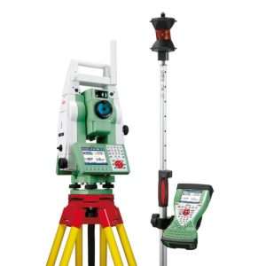
Geodetic total station
With its capabilities, we can determine the coordinates of unknown points in the field with high — even millimetre‑level — accuracy in a relative coordinate system, or in an absolute geodetic system when using control points. Thanks to the servo‑driven design of our Leica total station, its automatic prism‑searching, aiming and tracking functions, and the use of a 360° prism, it can operate in “one‑person robotic mode” (without an assistant), enabling highly efficient surveying. In reflectorless mode, it can be used at distances of up to 400 metres.
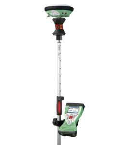
Geodetic GPS receiver
With this instrument, we can determine the coordinates of unknown points in the field with relatively high — centimetre‑level — accuracy. No geodetic control points with known coordinates are required, as the measurement takes place in an absolute coordinate system referenced to the Earth’s centre of mass. Higher accuracy is achieved through correction signals from terrestrial reference stations and the application of the VITEL transformation. Our Leica Viva GPS receiver can be mounted directly onto the 360° prism for efficient field operation and is fully controllable from the total station’s field controller.
3D static laser scanner
The instrument uses a rapidly rotating laser beam to scan and “capture” its surroundings in 3D. Within a very short time, it can determine the relative 3D coordinates of an extremely large number of points — up to 900,000 points per second — with centimetre‑level accuracy. The Faro scanner we use has a measurement range of 330 metres, making it highly effective for outdoor applications as well.
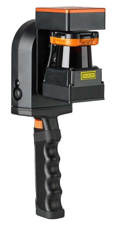
3D mobile laser scanner
Like the static laser scanner, the instrument uses a rotating laser beam to scan and “capture” its surroundings in 3D, but it records a smaller amount of data — approximately 40,000 points per second — with lower accuracy and resolution. Its key advantage is mobility: instead of a tripod, it can be operated handheld, allowing highly efficient data collection through slow, continuous walking. Due to the orientation technology used during measurement, we primarily apply it indoors, though it can also be useful outdoors for tasks requiring lower accuracy.
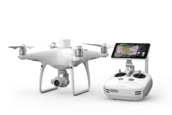
Geodetic surveying drone
Using photogrammetric processing, high‑overlap images captured from multiple directions can be used to extract 3D information with high accuracy — typically 1–2 cm. This requires a drone equipped with a geodetic‑grade RTK GPS receiver and ground control points determined with geodetic methods. During evaluation, a very high‑resolution 3D point cloud and orthophoto can be produced in a short time, making drone‑based surveying an excellent complement to traditional geodetic techniques.
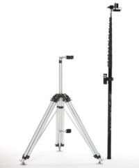
High‑elevation photo masts
Using a carbon‑fiber or alloy telescopic mast, we can capture photographs from heights of 8–12 metres during photogrammetric surveys, and the same technology allows us to elevate the mobile 3D scanner to approximately 5 metres. We primarily use these masts for urban and façade imaging, where drone photography is restricted by aviation regulations or where obtaining airspace permissions would be time‑consuming.
Software solutions

ArchiCAD architectural design software
ArchiCAD, developed by Graphisoft, has been a leading solution in the BIM‑based architectural design market for many years. Using the software, we create floor plans, section drawings, elevation drawings or full 3D building models based on photogrammetric and geodetic surveys or 3D scanning. Deliverables are provided to our clients in ArchiCAD .pln/.pla formats (or any other preferred file format).

AutoCAD Map GIS software
With AutoCAD Map, developed by Autodesk, we primarily process geodetic survey data. Using the software, we mainly produce contour‑based site plans.

Carlson Survey and Carlson PointCloud software
With Carlson’s Survey and PointCloud products, we also create contour‑based site plans and 3D terrain models, and we partially process data originating from drone surveys or laser scanning. Since these tools are specifically designed for land surveyors, they provide effective support for handling and processing raw data from geodetic instruments.
Faro SCENE point‑cloud processing software
With Faro’s SCENE software, we process the data captured by the static scanner. The software is used for orienting, cleaning, trimming and, when needed, re‑sampling (“downsampling”) point clouds. It also enables us to generate orthophotos or even 3D virtual tours.

GeoSLAM HUB and GeoSLAM Draw point‑cloud processing software
GeoSLAM HUB is used to process the data captured by the mobile 3D scanner, while GeoSLAM Draw allows us to create various deliverables from the processed data (such as orthophotos, section and elevation drawings, virtual walkthroughs and 3D terrain models).
Ready to bring your project to life?
Contact us and request a personalised quote for our engineering‑precision solutions.