


Photogrammetry
With our advanced photogrammetric methods, we restore visual information to its original spatial geometric reality, enabling dimensionally accurate, remotely performed surveying and analysis of buildings and objects — all through post‑processing that eliminates the need for on‑site presence.
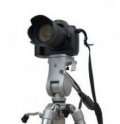
The science of photogrammetry deals with the high‑precision determination of the position and shape of the Earth’s surface and various objects (such as buildings) based on photographs. With photogrammetry, measurements are not carried out directly on site, but through the subsequent evaluation of images.
One of the core activities of Photo.metric Ltd. — reflected in its name — is the extraction of metric, dimension‑defined information from photographs using photogrammetric methods. These techniques make it possible to reconstruct the “original” spatial geometric information from planar image data.
Our photogrammetric services
The advantages of applying photogrammetry
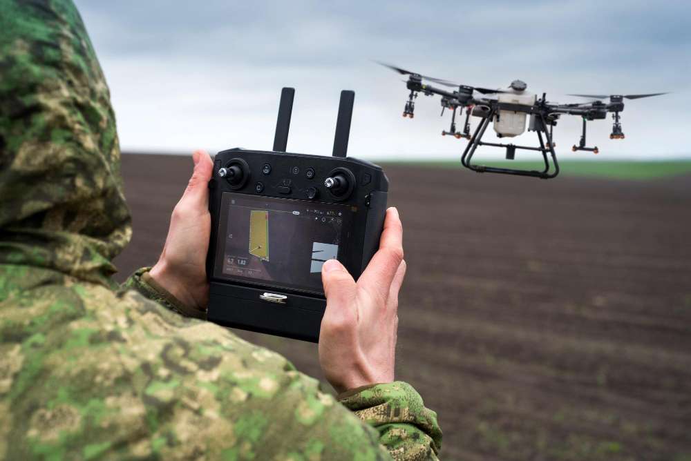
With minimal on‑site work (photography and control‑point measurement), an enormous amount of information can be collected extremely quickly.
It is particularly suitable for surveying hard‑to‑access areas and objects — such as busy intersections, radio towers, high‑voltage lines or marshy terrain.
It enables the rapid surveying of large‑scale areas — aerial photogrammetry is one of the most important methods used in modern map production.
With digital photogrammetric methods, a wide range of innovative and visually compelling products can be created — such as orthophotos or photorealistic 3D models. These products contain far richer background image data than traditional deliverables, providing significantly more information and offering a much clearer, more intuitive representation of the surveyed area or object.
The main fields of photogrammetry
Aerial photogrammetry
In aerial photogrammetry, photographs are taken from the air at relatively high altitudes — typically from drones or aircraft — capturing the Earth’s surface. Aerial photogrammetry evaluates near‑vertical aerial images, using either two‑image stereo methods or single‑image orthophotoscopic techniques.
With aerial photogrammetry, the Earth’s surface can be mapped and represented in three dimensions. Its typical outputs include 3D terrain models, digital orthophotos (as used, for example, in Google Maps), and various topographic maps.
Close‑range photogrammetry
In close‑range photogrammetry, the photographs do not depict the Earth’s surface but various objects taken from short distances. Its applications are highly diverse — from heritage documentation and architectural surveying to accident‑scene reconstruction and even medical use.
Close‑range photogrammetry evaluates short‑distance images (typically captured from the ground or a tripod), usually with oblique camera axes, using multi‑image or single‑image (orthophotoscopic) methods. Its characteristic outputs include orthophotos (e.g., of façades or frescoes) and 3D models.
The combined use of geodetic and photogrammetric methods is particularly suitable for:
- for surveying large‑scale areas.
- for documenting archaeological excavations.
- for surveying and documenting heritage buildings and monuments.
- for determining the volume of stockpiles.
- for surveying the routes, junctions and components of linear infrastructure.
- for surveying open‑pit mines.
The history of photogrammetry
The history of photogrammetry is almost as old as photography itself, although its theoretical foundations can be traced back even earlier. The practical application of photogrammetry began around 1859, when the height of the towers of Notre‑Dame in Paris was determined using photographs. In its early era, photogrammetry relied exclusively on terrestrial images, primarily for architectural purposes (architectural photogrammetry).
The adaptation of terrestrial photogrammetric evaluation methods to aerial photographs was developed in 1923. Beyond architectural surveying and topographic mapping, even in these early years many other fields sought to exploit the potential of photogrammetry — for example, the first contour drawings of skulls were produced during this period. Between the two World Wars, photogrammetry experienced significant development, especially in the field of aerial photogrammetry, which eventually displaced other methods entirely in topographic cartographic surveying.
Analog photogrammetry
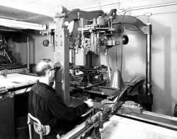
In the early period of photogrammetry (the so‑called analog era), only optical‑mechanical instruments existed, and photographs (negatives) were evaluated using special projectors. The images produced by the projectors of analog photogrammetric instruments were perceived separately by the left and right eye, thus providing stereoscopic vision.
Analog photogrammetric evaluation made it possible, on the one hand, to determine the terrain coordinates of specific points, and on the other hand, by moving the measuring mark of the instrument (which the observer also saw stereoscopically) within the perceived spatial model, it was suitable for producing contour‑based site plans — using a drawing device mechanically connected to the photogrammetric instrument.
Analytical photogrammetry
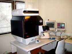
The next stage in the development of photogrammetry emerged in the 1960s, when the rapid advancement of computer technology made it possible for the analog era to be replaced by so‑called analytical photogrammetry.
Analytical photogrammetric evaluation instruments are already controlled by a computer, yet they still create the spatial model by projecting traditional photographic negatives. A key difference compared to analog photogrammetric instruments is that the evaluation result is now a digital dataset, which can be processed with any CAD software.
Digital photogrammetry
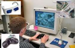
The final stage in the development of photogrammetry emerged in the 1980s, when advances in digital cameras and film scanners enabled the rise of digital photogrammetry. With digital photogrammetric workstations, the entire workflow is carried out digitally — meaning that traditional photo negatives are no longer used, but replaced by digital images.
Digital photogrammetric workstations also provide the possibility of spatial (stereo) visualization of image pairs. On the monitor, the left and right images of the stereo pair appear alternately, while the “liquid‑crystal shutter” built into the glasses synchronously blocks one eye and then the other. If this cyclic process repeats rapidly enough, the brain perceives the two alternating images as a single continuous spatial still image.
Ready to bring your project to life?
Contact us and request a personalised quote for our engineering‑precision solutions.