


Building survey
Comprehensive building‑survey solutions from high‑precision data acquisition to final documentation. Whether surveying family homes, complex industrial facilities, or historically significant heritage buildings, our technological capabilities and engineering expertise ensure reliable, accurate results tailored to every client’s specific requirements.
From small apartments to heritage buildings, shopping centres, office complexes, and even large‑scale power plants, we have carried out building surveys for a wide variety of properties over the past years.
Our clients include private individuals, architectural studios, property‑management companies, and municipalities. As a result, the size, nature, and purpose of each survey can vary significantly. By adapting to our clients’ needs, we always strive to identify the most efficient solution and technology — from field data acquisition to data processing and the presentation of the final deliverables.
Our core property‑survey services
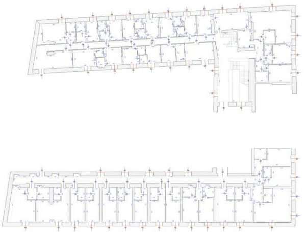
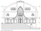
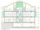
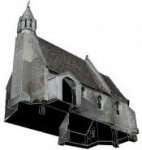
Additional services related to building surveying:

Why choose us:
01 – WE USE A WIDE RANGE OF TECHNOLOGIES
During our building‑survey projects, we always aim to select the most appropriate surveying method for the specific task at hand. Depending on the requirements, we apply a wide range of techniques — from laser distance meters connected to PDAs, through geodetic methods, to various photogrammetric procedures.
When surveying a property, we adapt to the nature of the assignment and, with a deep understanding of the strengths and limitations of each technology, we choose the most cost‑effective solution. Since the different surveying methods complement one another well, we typically use multiple techniques during the survey of a building.
If the requirements and the characteristics of the property indicate that 3D laser scanning is the most suitable approach, we can provide this service through our partners. The processing of the laser‑scanned data is carried out by us, incorporating additional surveying information (such as geodetic measurements) as needed.
02 – CAFM KNOWLEDGE
We carry out interior building surveys in accordance with facility‑management requirements and area‑measurement standards, depending on the specific needs of the project.
During the preparation of the building floor plans, we take into account aspects that can significantly reduce the future cost of implementing a CAFM system.
03 – SURVEYING METHODOLOGY
To ensure efficient and unambiguous work, we define the building‑survey workflow and its key characteristics — such as area definitions — within a surveying methodology agreed upon with the Client.
04 – SUPPLEMENTARY SERVICES
In addition to the services listed above, we offer a wide range of supplementary solutions — such as virtual tours, aerial photography, and geoinformatics.
Applications of building surveys:
Design & Construction
When extending an existing building, having precise knowledge of the actual current condition is essential, as it forms the foundation of the design process. During construction or renovation works, the data obtained from the property survey can be effectively used — for example, to calculate material quantities. At the end of the construction phase, another survey is required to prepare the as‑built documentation.
Property Operation / Facility Management
The foundation of effective property operation is a highly accurate, up‑to‑date surveying documentation — for example, for defining leased areas or carrying out repair and renovation tasks. In more complex cases, the survey plans serve as the basis for a facility‑management (CAFM) system.
In certain situations, a property must be surveyed due to legal requirements. For instance, preparing a fire‑protection plan or determining and substantiating local municipal taxes (such as property tax) may require certified, current surveying documentation and area statements.
Ready to bring your project to life?
Contact us and request a personalised quote for our engineering‑precision solutions.