


Aerial photography and panoramic imaging
The freedom of elevated viewpoints while standing on the ground: with our innovative photography system reaching up to 15 metres and our interactive virtual tours, we offer a new perspective that revolutionises the electronic presentation of your properties.
Complementing our photogrammetry service, we have introduced an innovative technology that allows us to capture aerial photographs from a height of up to 15 metres — while standing safely on the ground.
Another photography‑related service we offer is the creation of interactive panoramic images and virtual 3D tours, opening up an entirely new perspective in the field of electronic presentation.
Ground‑based aerial photography – low‑altitude imaging
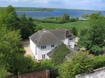
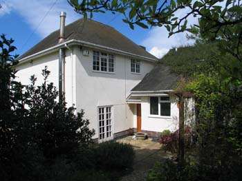
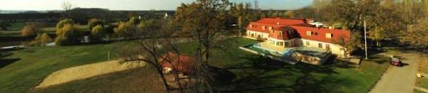
We capture our aerial photographs from heights of up to 15 metres — using a special telescopic photography mast, while standing safely on the ground. This method is likely unique in the country.
With this technique, large‑scale areas (plots, construction sites, parks) as well as buildings (hotels, guesthouses, restaurants, family homes) can be presented and documented exceptionally well.
Panoramic photography – VR tour
Our standalone 3D panoramic images can be seamlessly stitched together, resulting in what is known as a “3D virtual tour”. With these tours, users can explore the property — such as a restaurant or hotel — from their computer as if they were physically walking through it.
The structure of the 3D tour can be fully customised to the Client’s needs: interactive maps, menu items, and links can be added freely. This allows the creation of an independent web‑based presentation built entirely around the 3D tour.
Our photography services
Using a professional camera mounted on top of a 15‑metre telescopic photography mast. And if this height is not sufficient, we can — with the help of our Partners — capture images from several hundred metres using a model helicopter, powered hang glider, or light aircraft.
If you want more than a simple photograph, take advantage of the possibilities offered by modern technology. With our online‑published 360° panoramic images, you can look around freely — as if you were standing right inside the scene.
By stitching multiple panoramic images together, you can embark on a virtual tour directly through the internet — and additional information can be attached to individual elements within the photos.
By filtering out the geometric distortions inherent in conventional photographs, an orthophoto map can be created — combining the advantageous properties of both photographs and maps. Individual orthophotos can be perfectly aligned with one another (a well‑known example of this is the satellite imagery used in Google Maps).
Using a calibrated camera and measured control points, the resulting images can be evaluated at any later time using photogrammetric methods.
Areas of application
Hospitality and tourism
Real estate sales and rentals
Architecture and interior design
Construction industry
Archaeology
Ready to bring your project to life?
Contact us and request a personalised quote for our engineering‑precision solutions.