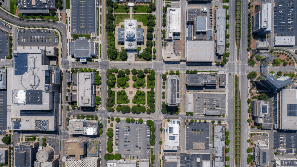
Orthophoto
One of the most common products of photogrammetric methods is the orthophoto, or “photo‑map,” which—thanks to the rapid advancement of computer technology—has become part of everyday life (e.g., the Google Maps application).
What do we call an orthophoto?
An orthophoto resembles a traditional photograph in appearance, but it is free from all geometric distortions and has a uniform scale, allowing precise measurements to be performed on it. Like most maps, an orthophoto is an orthogonal projection of the Earth’s surface.
It essentially combines the advantageous properties of photographs and maps, which is why it is often referred to as a “photo‑map.” Naturally, orthophotos can be produced not only of the Earth’s surface but of any other object as well (e.g., buildings).
What makes an orthophoto special?
Unlike conventional photographs, an orthophoto is free from perspective distortions and is characterized by a uniform scale.
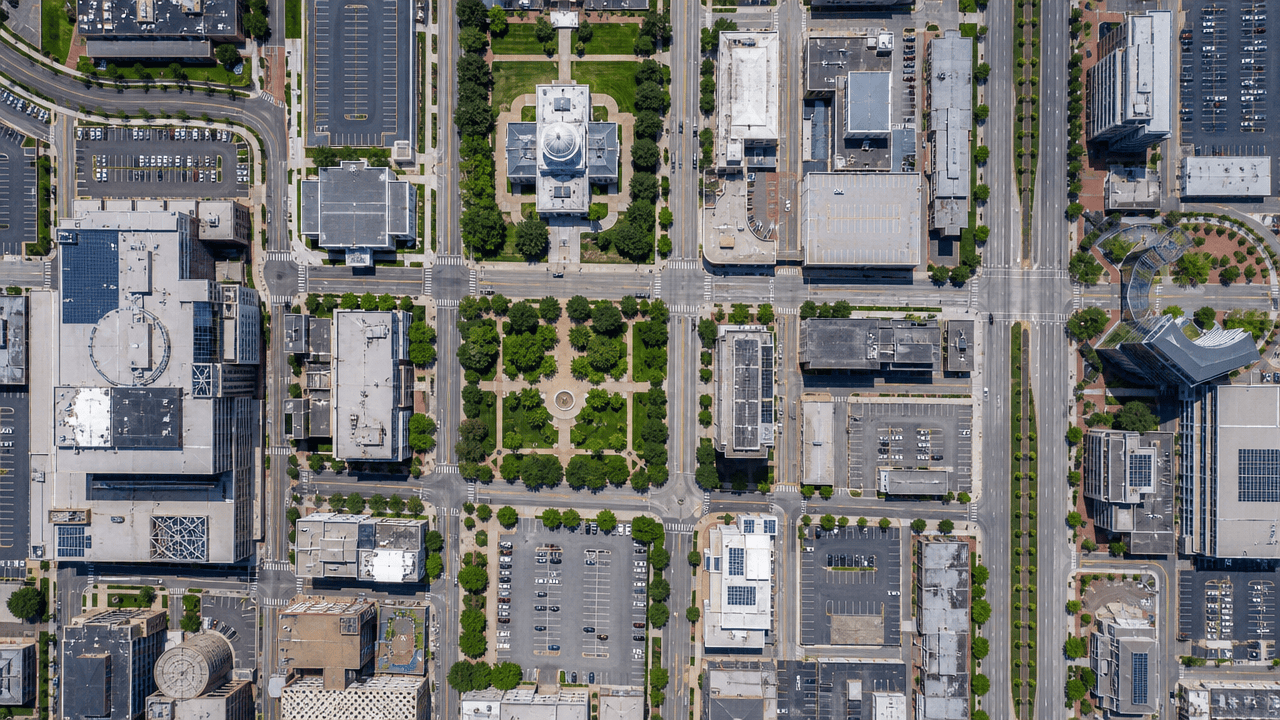
Geometric fidelity
It is the perpendicular (orthogonal) projection of the Earth’s surface or of buildings, meaning that the points in the image appear according to their true coordinates.
Distortion‑free representation
During the process, we correct perspective distortions, tilt effects caused by elevation differences, and optical lens aberrations.
True Orthophoto Technology
With our specialized procedure, every single pixel is represented at its true spatial position, ensuring that terrain objects (such as trees and buildings) do not “lean,” but appear exactly as seen from above.
Application Areas
We focus our services on two main areas.
Surface Surveys
Photomaps generated from aerial imagery for integration into geospatial information systems, for updating thematic maps, or for conducting spatial analyses.
Architectural and Conservation Documentation
- Façade Survey: Precise, true‑to‑scale elevation drawings produced even in dense urban environments.
- Heritage Conservation: Distortion‑free documentation of wall paintings, frescoes and architectural details—an essential foundation for accurate restoration work.
How We Work
In our digital photogrammetric workflow, the photographs are “reprojected” using the camera’s calibration parameters and the object’s spatial model (digital surface model).
Data Acquisition
We know the exact position of the camera and the shape of the object (determined through geodetic measurements or laser scanning).
Pixel‑based Correction
Our software recalculates every single pixel to its true spatial position.
Result
A digital document that retains the rich informational content of a photograph, yet can be used as an engineering drawing.